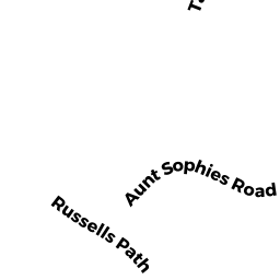
40 AUNT SOPHIES ROAD
Owner Information
CONLIN BRENDAN A &
40 AUNT SOPHIES ROAD
BREWSTER, MA 02631


Property Details
40 AUNT SOPHIES ROAD is classified as a Single Family Residential (Cape).
The primary structure on this property was built in 2001. There are 1,296ft2 of built area within this property. There is 1,296ft2 of residential/living space within this property. This property is listed as having 5 rooms.
40 AUNT SOPHIES ROAD is valued at $421,800. The land is valued at $168,500 and the structures are valued at $251,300. There is an additional valuation of $2,000 on this property.
This property is in Zone RM. Confirm with local Zoning Board authorities to ensure there are no overlays or other easements on this property.
The most recent deed for 40 AUNT SOPHIES ROAD is recorded at the local registrar in Book 28162, Page 301. 40 AUNT SOPHIES ROAD was last sold on Friday, May 23, 2014 for $326,701.
Assessment data from fiscal year 2022.
Flood Data
According to the FEMA National Flood Hazard Layer, this property does not appear to be in a flood zone. It may also be in an area not yet reviewed. Nonetheless, confirm this information prior to taking any action.
To view the flood hazards around this property, create a FEMA "Firmette" Map of the area around 40 AUNT SOPHIES ROAD.
Broadband Internet Providers
| Provider | Type | Bandwidth (mbps) | |
|---|---|---|---|
| VSAT Systems, LLC. | Satellite | 2 | 1 |
| Verizon New England Inc. | DSL | 5 | 0 |
| Comcast | Cable | 1000 | 35 |
| Viasat Inc | Satellite | 35 | 3 |
| GCI Communication Corp. | Satellite | 0 | 0 |
| HughesNet | Satellite | 25 | 3 |
Broadband service provider data from December 2020.
Adjacent Properties
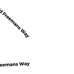
- 147 FREEMANS WAY
Single Family Residential owned by FREEMANS RESIDENCE LLC - 0 RUSSELLS PATH
Developable Residential Land owned by BELTIS GERALD C & - 127 RUSSELLS PATH
Single Family Residential owned by PICHE CAROLE - 135 RUSSELLS PATH
Single Family Residential owned by BELTIS D MARK - 56 AUNT SOPHIES ROAD
Single Family Residential owned by SUTHERLAND THOMAS A & SUSAN A TRUSTEES - 147 RUSSELLS PATH
Single Family Residential owned by KALINOWSKI MICHAEL & LESLIE